Mallows Bay - A Historical Treasure
Welcome to the Mallows Bay–Potomac River National Marine Sanctuary virtual trail. A partnership between the sanctuary, the National Marine Sanctuary Foundation, and Terrain360, this website takes you on a virtual tour around the sanctuary waters and the park, all with a 360-degree view. Choose from many hiking and water trails, or other themes, such as shipwrecks or ecology. On each trail, don’t miss the clickable “hotspots” for photos, videos, and fun facts about the features of Mallows Bay. Click along the maps on each page to start your virtual tour or jump to your favorite hotspot!
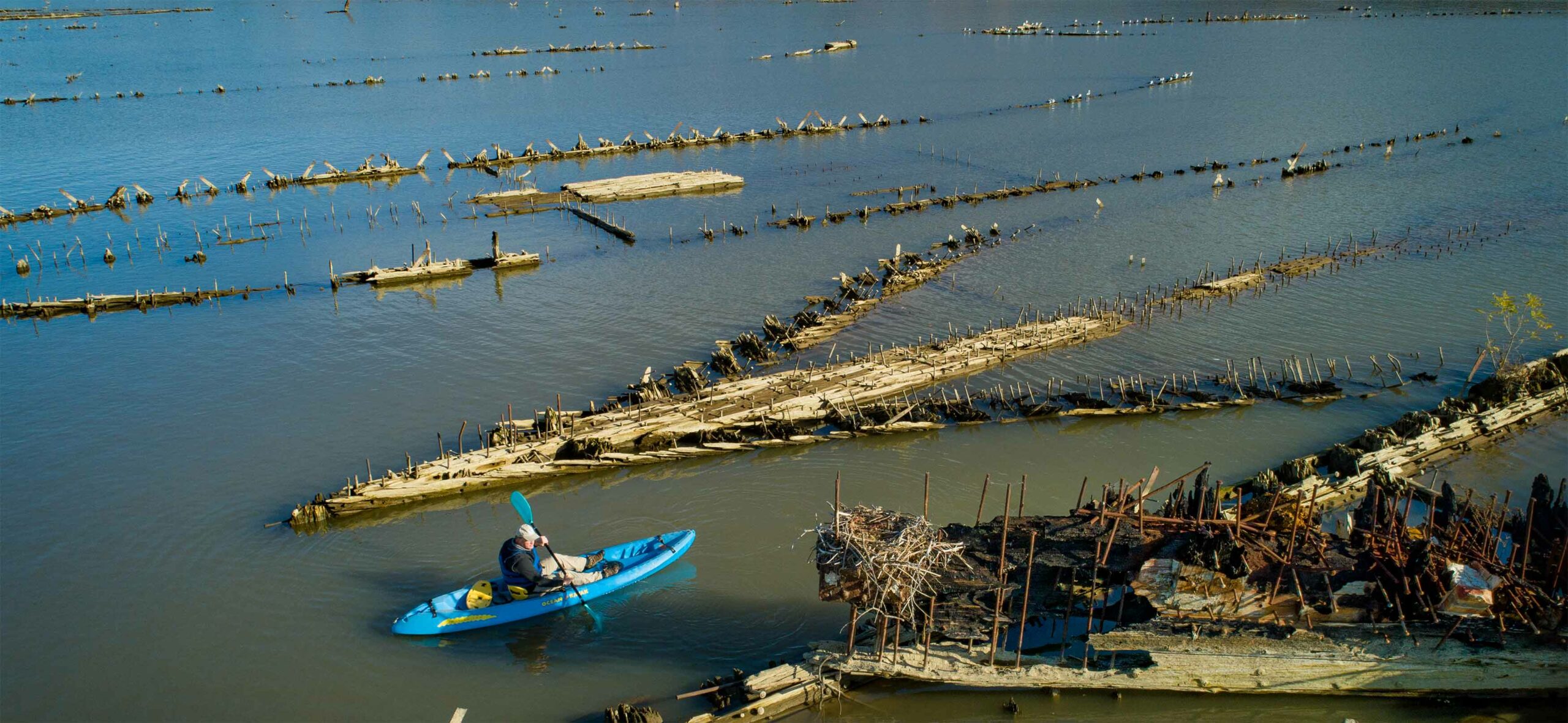
The sanctuary protects and interprets the remains of more than 100 World War I-era wooden steamships, known as the “Ghost Fleet” and other maritime resources, including indigenous history and culture dating back nearly 12,000 years. The sanctuary is where history and nature come together to give a one-of-a-kind experience. There is something for everyone. You can walk the shore, see wildlife, fish, or paddle the waters. The shipwrecks are best seen at low tide. They form habitats for many fish, plants, and animals, such as ospreys, bald eagles, herons, beavers, and more.
To learn more about Mallows Bay-Potomac River National Marine Sanctuary visit our website!
Interactive Map
Mallows Bay EMERGENCY & SAFETY INFORMATION
Due to the location of the park, during an emergency please call the Charles County Sheriff’s Department, they will connect caller with the county 911 services.
The number is 301-932-2222
*Please install this number on your device.
PADDLING SAFETY TIPS
- ALWAYS WEAR YOUR LIFE JACKET.
- PADDLE WITH OTHERS IF POSSIBLE.
- COLD WATER TEMPERATURES ARE HAZARDOUS TO PADDLERS. Paddling is recommended between May and September.
- WHEN PADDLING IN WIND, STAY CLOSE TO SHORE.
- RESPECT WILDLIFE. Animals and birds should be viewed from a distance.
- BEWARE OF HIDDEN WRECKS. It is dangerous to travel through the central shipwreck cluster, especially during high tide when ship remains lie just below the waterline and are invisible to the paddler.
Getting There
AMENITIES:
Include a boat ramp, soft launch, portable toilets, parking, walking trail, interpretive signs, and picnic area.
HOURS:
The park is open daily from 5:30 am to sunset.